Interlaken Hiking Trails: 9 Best Hikes I Did in 2026 (With Real Distances and Tips)
Interlaken Hiking Trails: 9 Best Hikes I Did in 2026 (With Real Distances and Tips)
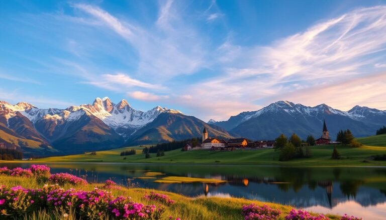
Interlaken sits between two turquoise lakes with the Eiger, Mönch, and Jungfrau as its permanent backdrop. I’ve hiked every trail on this list personally — some took my breath away (the good kind), one nearly made me regret my life choices (the Schynige Platte ridge in a thunderstorm). Here’s what you actually need to know before lacing up your boots.
⚡ Key Takeaways
- Best beginner hike: Harder Kulm — 2.4km, 700m elevation gain, panoramic views of Lakes Thun and Brienz
- Best full-day hike: Schynige Platte to First — 15km ridge walk with 360° Alpine views
- Best hidden gem: Iseltwald to Giessbach Falls — mostly flat, waterfall reward at the end
- Best season: Late June to mid-October (trails fully open, no snow risk)
- Travelpayouts affiliate: Book accommodation and trains directly from Interlaken hotels to save
Table of Contents
- Harder Kulm — The Classic Interlaken Hike
- Schynige Platte to First Ridge Walk
- Iseltwald to Giessbach Falls
- Lauterbrunnen Valley Loop
- Brienzer Rothorn Summit Hike
- Bachalpsee via First
- Grindelwald First Cliff Walk
- Niederhorn via Beatenberg
- Männlichen to Kleine Scheidegg
- Practical Tips: When to Go, What to Pack, Costs
- FAQ
1. Harder Kulm — The Classic Interlaken Hiking Trail for Beginners
Harder Kulm is the most iconic Interlaken hike, and for good reason: 700 metres of vertical gain, a viewpoint restaurant at 1,322m altitude, and a sight line that takes in both Lake Thun and Lake Brienz simultaneously. I hiked it on a Tuesday morning in July 2025 — took me 1h45min going up, and I passed maybe 20 other hikers the whole way.
Distance: 2.4km one way (4.8km return) | Elevation gain: 700m | Difficulty: Moderate | Time: 1.5–2.5 hours up
What Makes Harder Kulm Special
The trail starts directly in Interlaken East (near the funicular station) — no bus or train needed. The path climbs steeply through beech and pine forest, with occasional clearings offering glimpses of the valley below. At the top, the “Two Lakes Bridge” extends over a cliff edge, giving you a vertiginous view straight down to Interlaken town.
The funicular runs up and down if your legs give out on the descent (CHF 20 one-way). I always recommend hiking up and taking the funicular down — knees will thank you.
Trail Conditions and Timing
The trail is marked year-round but can be icy from November to April. Best window: May to October. Arrive before 9am in July/August to avoid tour groups arriving via funicular. Sunset here is spectacular — last funicular down is typically around 9pm in summer.
| Detail | Info |
|---|---|
| Start point | Interlaken East (Harder Kulm trailhead, near funicular) |
| Distance | 2.4km one-way / 4.8km return |
| Elevation | 1322m summit (700m gain from town) |
| Difficulty | Moderate (steep but no scrambling) |
| Duration | 1.5–2.5h up | 1–1.5h down |
| Best months | May–October |
| Cost | Free to hike | Funicular CHF 20 one-way |
2. Schynige Platte to First — Best Full-Day Interlaken Hike
If you only do one full-day hike from Interlaken, make it this one. The Schynige Platte to First ridge walk covers 15km with 700m gain and 1,400m descent, spending almost the entire route above 2,000m with unobstructed views of the Bernese Alps. I did it in 6 hours moving time in September 2025 — it was the best hiking day I’ve had in Switzerland.
Distance: 15km | Elevation gain: 700m | Elevation loss: 1,400m | Difficulty: Hard | Time: 6–8 hours
How to Plan the Schynige Platte to First Route
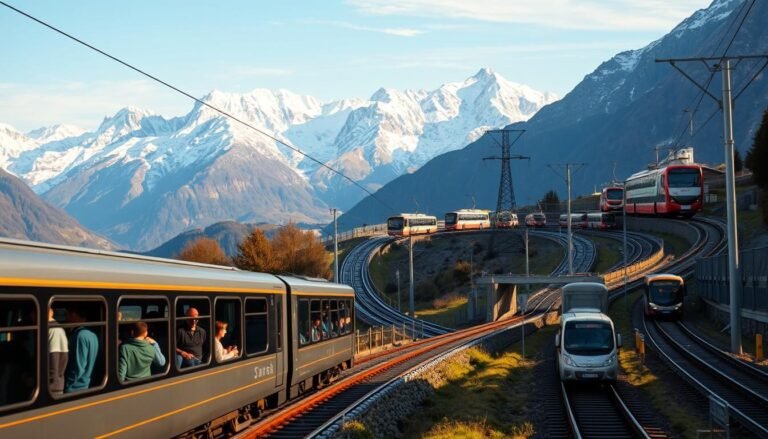
Take the Bernese Oberland Railway from Interlaken East to Wilderswil, then the rack railway up to Schynige Platte (1,967m). The hike heads east along the ridge, passing the Faulhorn summit (2,681m — the highest point on this walk), then descends to First station above Grindelwald. From First, take the gondola down to Grindelwald and catch a train back to Interlaken.
The Faulhorn section is the hardest part — rocky, exposed, and taxing. It’s also where you’ll find the oldest mountain inn in Switzerland, the Berghotel Faulhorn (open in summer). If weather looks uncertain, start at 8am to avoid afternoon thunderstorms common in July and August.
What I Wish I’d Known Before This Hike
- The rack railway to Schynige Platte is seasonal (late May to late October only) — check dates before planning
- Carry at least 2 litres of water — no reliable water sources on the ridge section
- Wind on the Faulhorn ridge can be brutal even in summer — pack a windproof layer
- Book the last gondola from First in advance during peak summer — they fill up
3. Iseltwald to Giessbach Falls — Best Easy Lakeside Hike Near Interlaken
This hidden gem took me by surprise. Iseltwald (known for the “Squid Game” dock scene) to Giessbach Falls is a 5km mostly-flat trail hugging the southern shore of Lake Brienz. The payoff is a 14-tier waterfall that drops 300m directly into the lake — with a historic hotel perched alongside it.
Distance: 5km one-way | Elevation gain: Minimal | Difficulty: Easy | Time: 1.5 hours one-way
Trail Details and How to Get There
Take the train to Brienz, then a boat or bus to Iseltwald. The trail follows the lake’s edge, passing through several small tunnels carved into the cliff face. In autumn, the beech trees turn golden and reflect in the emerald lake — genuinely one of the most photogenic walks in Switzerland.
At Giessbach, the historic Grand Hotel Giessbach serves lunch on a terrace overlooking the falls (expect CHF 25–40 for a meal). A free funicular (one of the oldest in Switzerland) takes you to a better viewpoint above. Boats run back to Interlaken from the Giessbach pier in summer.
4. Lauterbrunnen Valley Loop — Best Family-Friendly Hike from Interlaken
Lauterbrunnen is 15 minutes by train from Interlaken and sits inside Switzerland’s most dramatic valley — 72 waterfalls cascade from 300m-high cliff walls. The valley floor loop (8km, mostly flat) is perfect for families, casual hikers, or anyone who wants to stare at Staubbach Falls without climbing anything.
Distance: 8km loop | Elevation gain: Under 100m | Difficulty: Easy | Time: 2–3 hours
Extending to Wengen or Mürren
The valley floor loop is satisfying on its own, but you can extend it significantly. From Lauterbrunnen, a cog railway climbs to Wengen (car-free village, spectacular Eiger views) or a cable car reaches Grütschalp, from where a flat trail leads to Mürren. Both extensions add 2–3 hours and require paid transport (Swiss Travel Pass covers both).
For waterfall chasers: Trümmelbach Falls (CHF 11 entry) is inside the mountain — a series of glacial meltwater cascades accessible via a carved rock tunnel and lift. It’s noisy, wet, and magnificent.
5. Brienzer Rothorn — Best Summit Hike Near Interlaken
The Brienzer Rothorn (2,350m) offers the best summit-to-effort ratio of any hike near Interlaken. A steam-powered cog railway (one of Switzerland’s last) takes you to 1,840m, leaving only 500m of gain to the actual summit. Views span from the Bernese Alps to the Bernese Mittelland flatlands.
Distance from top station: 3km one-way to summit | Elevation gain: 500m | Difficulty: Moderate | Time: 2 hours one-way from cog railway top station
Why Rothorn Beats Schilthorn for Views
Schilthorn has the James Bond reputation and the revolving restaurant. Brienzer Rothorn has something better: almost no crowds. I went up on a Sunday in August and counted fewer than 30 hikers on the summit trail. The 360° view includes Lake Brienz directly below, Lake Thun in the west, and on clear days, Mount Blanc on the French border.
The old steam train departs from Brienz station (20 minutes from Interlaken by train). Round trip costs CHF 52; hiking both ways saves money but takes the whole day. Note: the cog railway is seasonal — typically late May to late October.
6. Bachalpsee via First — Best Alpine Lake Hike from Interlaken
Bachalpsee is arguably the most photographed lake in the Bernese Oberland. The mirror-like pool at 2,265m reflects the Schreckhorn and Wetterhorn peaks on calm mornings, creating images that look artificially enhanced. Getting there requires the First gondola from Grindelwald, then a flat 2.5km walk to the lake.
Distance from First station: 2.5km one-way | Elevation gain: 200m | Difficulty: Easy | Time: 1 hour from First
Best Time for the Perfect Bachalpsee Reflection Photo
Wind dies down in the early morning (before 10am), creating the glassy surface that makes the lake famous. Arrive at First when the gondola opens (8am in summer) and walk the 2.5km before day-trippers arrive. In July/August, by 11am the lake shore can hold 100+ people — still beautiful, but the Instagram moment is gone.
The trail continues past Bachalpsee to Faulhorn (2 more hours) and eventually to Schynige Platte (see trail #2 above). You can string these together for a massive traverse.
7. Grindelwald First Cliff Walk — Best Easy Alpine Experience Near Interlaken
Not a traditional hike — the First Cliff Walk is a 1km metal walkway bolted to the cliff face at 2,168m. It’s the same altitude as some of the harder hikes on this list, but accessible to anyone willing to take the gondola up. The experience of walking along an exposed ledge above Grindelwald is genuinely thrilling.
Distance: 1km (cliff walk section) | Difficulty: Very Easy (but exposed) | Cost: CHF 35 gondola | Time: 30 minutes for the cliff walk itself
Combining with Bachalpsee
Most visitors do the cliff walk and then add the Bachalpsee trail (see above) for a full half-day. The gondola ticket covers the cliff walk and gives you a base to explore the First plateau. First also has a Flyer zipline (CHF 29) and a mountain cart (CHF 17) if hiking isn’t your only priority.
8. Niederhorn via Beatenberg — Best Panorama Trail Near Thun Lake
The Niederhorn (1,936m) is the least-known peak on this list — and that’s exactly why I love it. Reachable by cable car from Beatenbucht (15 minutes from Interlaken by boat or bus), the summit trail offers a clean panorama over Lake Thun with far fewer visitors than the Jungfrau region trails.
Distance: 5km from cable car top station (loop) | Elevation gain: 400m | Difficulty: Moderate | Time: 2.5–3 hours
Wildlife and Wildflowers on the Niederhorn
The Niederhorn ridge is a nature reserve — you’re likely to see ibex, chamois, and marmots in the early morning. In June, the slopes are carpeted with alpine wildflowers including edelweiss. The loop trail skirts along a ridge before descending back to the cable car at Beatenberg — it’s compact but delivers views completely out of proportion to the effort.
9. Männlichen to Kleine Scheidegg — Best Beginner-Friendly Alpine Hike
The Männlichen to Kleine Scheidegg traverse is the most famous easy Alpine hike in Switzerland — and possibly the world. A nearly flat 5km ridge walk at 2,200m altitude with the Eiger north face directly ahead of you the entire time. I’ve done it three times and it never gets old.
Distance: 5km one-way | Elevation gain: Minimal (mostly downhill) | Difficulty: Easy | Time: 1.5–2 hours
Getting to Männlichen and Back
From Interlaken, take the train to Grindelwald (or Wengen), then a gondola or cable car up to Männlichen. The hike runs west along the ridge to Kleine Scheidegg, where you catch the cog railway down to Grindelwald or Wengen. Budget CHF 40–70 for the cable cars depending on your start point (Swiss Travel Pass gives a 25–50% discount on most).
Summer weekends at Kleine Scheidegg are very busy — the Jungfraujoch crowds pass through here. Weekdays in June or September are quieter and the light is often better for Eiger photography.
Practical Tips: When to Go, What to Pack, and Costs
Best Time for Hiking Near Interlaken
The hiking season runs from late May to mid-October. Here’s what each month offers:
| Month | Conditions | Crowds | Verdict |
|---|---|---|---|
| Late May–June | Snow possible above 2000m, wildflowers blooming | Low | Excellent — fewer tourists, fresh landscapes |
| July–August | Best weather, all trails open | Very high | Peak season — book everything in advance |
| September | Cooler, golden light, stable weather | Moderate | 🏆 Best month overall |
| October | Autumn colours, shorter days, some lifts closing | Low | Excellent for experienced hikers |
What to Pack for Interlaken Hikes
- Footwear: Waterproof hiking boots (trail runners OK for easier hikes)
- Layers: Temperature drops 6°C per 1,000m gained — always bring a mid-layer and windproof jacket
- Water: Minimum 2 litres — Swiss mountain water sources are safe to drink (look for blue tap symbols on maps)
- Navigation: Download the SwitzTopo app — the official Swiss map app, free and extremely accurate
- Sun protection: UV intensity is much higher at altitude — SPF 50 is not excessive
- Emergency layer: Foil emergency blanket (weighs nothing, could save your life in sudden weather)
Costs and Budget for Interlaken Hiking
The trails themselves are free. What costs money is the mountain transport:
| Transport | Approximate Cost (2026) | Swiss Travel Pass? |
|---|---|---|
| Harder Kulm funicular | CHF 20 one-way | No |
| Schynige Platte rack railway | CHF 42 one-way | 25% discount |
| First gondola (Grindelwald) | CHF 35 one-way | 25% discount |
| Männlichen cable car | CHF 30 one-way | 25% discount |
| Brienzer Rothorn cog railway | CHF 52 return | No discount |
| Kleine Scheidegg cog railway | CHF 15–30 | 50% discount |
The Swiss Travel Pass covers all trains between Interlaken and surrounding towns — this alone saves significant money if you’re doing multiple days. Book accommodation early: Interlaken hotels fill up fast in July and August, especially budget options.
Internal Resources
- Is the Swiss Travel Pass Worth It? Complete 2026 Guide
- Switzerland Travel Budget 2026: Real Costs
- Best Day Trips from Zurich 2026
Frequently Asked Questions: Hiking in Interlaken
What is the easiest hike in Interlaken for beginners?
The Männlichen to Kleine Scheidegg trail is the easiest scenic hike near Interlaken — it’s mostly flat, 5km long at 2,200m altitude, and offers direct views of the Eiger the entire way. The Iseltwald to Giessbach Falls trail is even easier if you prefer lake scenery over mountain panoramas.
Can you hike from Interlaken to Grindelwald?
There is no direct hiking trail between Interlaken town and Grindelwald — the valley terrain and distance make it impractical. Take the train (30 minutes, CHF 8–12) and start your hike from Grindelwald. From there, multiple trails connect to the First plateau, Männlichen, and the Bachalpsee lake.
Do I need hiking boots for Interlaken trails?
For easy trails (Männlichen to Kleine Scheidegg, Iseltwald to Giessbach), trail runners or sturdy sneakers work. For full-day hikes like Schynige Platte to First or the Brienzer Rothorn summit trail, waterproof hiking boots with ankle support are strongly recommended — rocky terrain and unpredictable weather make proper footwear worth the investment.
When do Interlaken hiking trails open?
Lower trails (Harder Kulm, valley walks) are accessible year-round. Higher Alpine trails above 1,800m typically open late May to early June, once winter snow has melted. Check current trail status on the MySwitzerland website before heading out.
How do I get to the Interlaken hiking trails without a car?
Interlaken has excellent public transport connections. All trails described here are accessible by train, bus, or boat from Interlaken East or West stations. The Swiss Travel Pass covers all regional trains and boats, and gives 25–50% discounts on most cable cars and gondolas. You genuinely don’t need a car for hiking in this region.