Best Swiss Mountain Hikes for Beginners 2026: Trails Anyone Can Do
best swiss mountain hikes beginners 2026
Quick answer: The best Swiss mountain hikes for beginners in 2026 are the Männlichen–Kleine Scheidegg trail (flat ridge walk with Eiger views), the Rigi Kulm ridge (above Lake Lucerne), and the Bachalpsee Lake loop — all yellow-marked Wanderwege accessible without alpine experience or special gear.
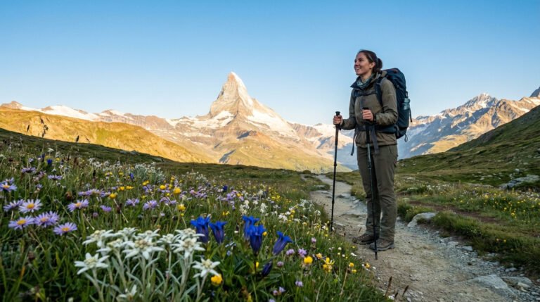
Switzerland has the paradoxical reputation of being both one of the world’s great hiking destinations and intimatingly steep terrain. The reality is more accessible than the reputation suggests. Switzerland has over 65,000 kilometers of marked hiking trails, many of which are specifically graded for hikers with no alpine experience — and several of which rank among the most scenically spectacular walks in the world. These are the best Swiss mountain hikes for beginners in 2026: trails with clear waymarking, manageable elevation, mountain restaurant access at the top, and views that justify every meter of climbing.
Understanding Swiss Trail Difficulty Ratings
Switzerland uses a standardized trail marking system that’s genuinely useful for assessing difficulty before you start:
- Yellow markers (Wanderweg): Easy hiking trails suitable for anyone with normal fitness. No special footwear required. These are the trails in this guide.
- White-red-white markers (Bergweg): Mountain hiking trails requiring basic fitness, sure-footedness, and proper hiking boots. Some exposure and steep sections.
- White-blue-white markers (Alpinweg): Alpine routes requiring experience, equipment, and technical skills. Not for beginners.
All trails in this guide are yellow-marked Wanderwege — meaning they’re accessible to anyone with reasonable fitness and appropriate footwear.
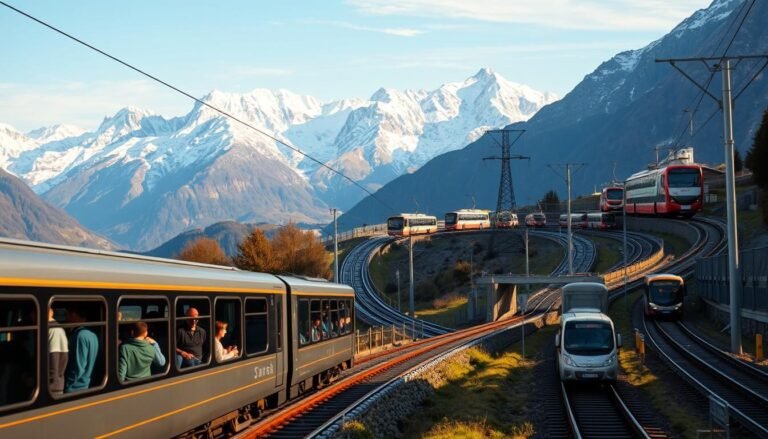
According to Switzerland Tourism (MySwitzerland.com), hiking is the #1 outdoor activity for international tourists visiting Switzerland, with 47% of visitors participating in some form of guided or independent hiking during their trip. The Swiss Federal Office for Tourism estimates that marked trails attract over 17 million day hikes annually. The official trail network is managed by SchweizMobil, Switzerland’s national active mobility network, which provides free route planning for all 65,000+ km of marked paths.
1. Männlichen to Kleine Scheidegg, Bernese Oberland
This is quite possibly the most spectacular easy hike in Europe. The trail runs along a ridge between two mountain stations above Grindelwald, with an uninterrupted panorama of the Eiger, Mönch, and Jungfrau for the entire walk. The path is almost entirely flat (it loses a small amount of elevation) and takes 1.5–2 hours at a comfortable pace.
Details: Take the Gondelbahn from Grindelwald or the cable car from Wengen to Männlichen. Walk to Kleine Scheidegg. From there, take the train back down to Grindelwald or Wengen. Round trip possible by train.
Difficulty: Easy. Yellow trail. 4km, minimal elevation change.
Season: Late June to October.
Crowds: This is one of Switzerland’s most popular trails — plan to go on a weekday morning for more space.
2. First Cliff Walk, Grindelwald
The First Cliff Walk is a constructed walkway above Grindelwald that combines easy hiking with vertigo-inducing transparency — sections of the path are glass-floored walkways cantilevered over the cliff face. It’s genuinely accessible (the path is wide and well-maintained) but provides a thrilling sense of exposure.
The trail extends from the First mountain station, accessible by gondola from Grindelwald, along the cliff with views down to the village and across to the Eiger. Return by gondola or continue to Bachalpsee Lake (a beautiful 30-minute extension).
Difficulty: Easy with optional moderate extension. 1.5–3km depending on how far you go.
Season: Late May to October.
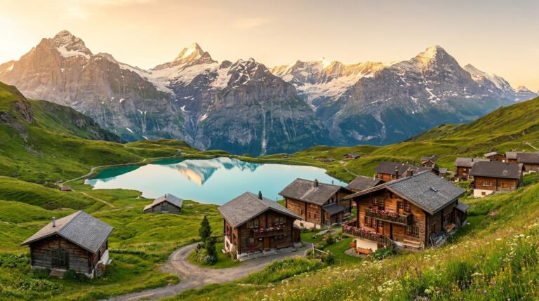
3. Rigi Kulm to Rigi Kaltbad, Mount Rigi
Mount Rigi, known as the “Queen of the Mountains,” sits above Lake Lucerne and offers one of Switzerland’s most accessible alpine panoramas. The ridge trail from Rigi Kulm (summit) to Rigi Kaltbad follows the mountain’s broad spine with 360-degree views: the Alps to the south, and the Swiss plateau with its lakes stretching north.
Both the summit and Kaltbad are served by mountain railways, meaning the entire experience can be completed without driving or difficult access.
Details: Take the railway from Arth-Goldau or Vitznau to Rigi Kulm. Walk the ridge (1.5–2 hours, easy). Take the cable car from Rigi Kaltbad down to Weggis for the lake.
Difficulty: Easy. Yellow trail. 5km, gentle descent.
Season: Year-round (winter with snowshoes).
4. Bachalpsee Lake Loop, Grindelwald First
Bachalpsee is one of Switzerland’s most photographed lakes — a perfectly still alpine lake at 2,265m that reflects the snow-capped Wetterhorn and Schreckhorn on calm mornings. The walk from the First gondola station to the lake and back is comfortably achievable by beginners and enormously rewarding in clear weather.
Details: Take the gondola from Grindelwald to First (2,168m). Walk to Bachalpsee (30 minutes each way). Return to First for the gondola down.
Difficulty: Easy. 3km round trip, 100m elevation gain.
Season: Late June to October.
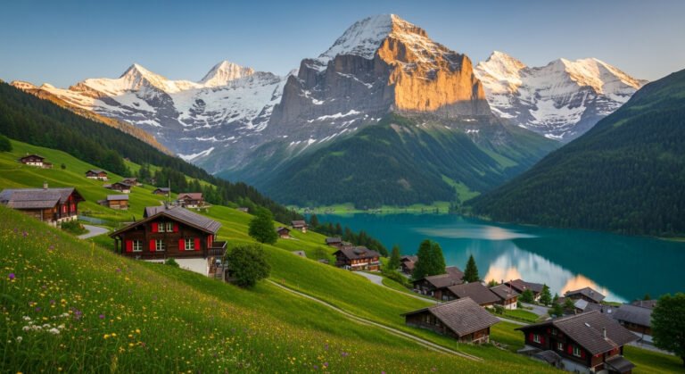
5. Schynige Platte Panorama Trail, Bernese Oberland
The Schynige Platte is reached by a historic rack railway from Wilderswil near Interlaken. From the summit, a panorama trail loops around the ridge with views of the Thunersee, Brienzersee, and the full Bernese Alps. The trail is broad and well-graded, with a mountain restaurant at the top.
Details: Take the rack railway from Wilderswil to Schynige Platte. Walk the full panorama loop (3 hours) or the shorter southern section (1.5 hours). Return by railway.
Difficulty: Easy to moderate. Yellow trail, 5–8km depending on route.
Season: Late June to October.
6. Five Lakes Walk, Zermatt (Rotenboden to Riffelalp)
This trail visits five mountain lakes, each reflecting the Matterhorn on clear mornings. It’s considered one of Switzerland’s classic walks and is graded as hiking (Wanderweg) despite the dramatic alpine setting. The start point is reached by the Gornergrat railway from Zermatt.
Details: Take the Gornergrat Bahn to Rotenboden (2,815m). Walk to Riffelalp (2,211m), passing five alpine lakes. Return by train from Riffelalp station.
Difficulty: Easy to moderate. 5km, 600m descent. Good fitness recommended.
Season: July to October.
For those planning a trip to Interlaken as a base for the Bernese Oberland hikes listed above, our Interlaken Switzerland Travel Guide 2026 covers the best neighborhoods to stay, transport logistics, and how to combine multiple day hikes efficiently. Interlaken is the most practical base for Männlichen, Bachalpsee, and Schynige Platte — three of the six trails in this guide.
Essential Gear for Swiss Beginner Hikes
Even on easy Swiss mountain trails, preparation matters:
- Footwear: Proper hiking shoes or boots with ankle support. Sneakers are technically possible on yellow trails but provide less comfort and stability on uneven terrain.
- Layers: Mountain weather changes rapidly. Bring a fleece or light insulated jacket even in summer — ridges and summits are significantly cooler than the valley below.
- Sun protection: UV radiation is significantly stronger at altitude. Sunscreen, sunglasses, and a hat are non-negotiable in alpine terrain.
- Water: 1.5–2 liters per person per hiking day minimum. Mountain streams are generally safe to drink in Switzerland but treatment tablets are a sensible precaution.
- Swisstopo App: Switzerland’s official topographic mapping app provides the most accurate trail information for Swiss hiking. Free tier covers basic navigation.
Getting to Swiss Mountain Trails Without a Car
Switzerland’s public transport system makes car-free hiking genuinely practical. All trails in this guide are accessible via train + mountain railway combinations. The Swiss Travel Pass provides unlimited travel on trains, buses, and most mountain railways — excellent value for visitors spending a week hiking multiple areas.
For detailed accommodation near the best hiking bases (Grindelwald, Interlaken, Zermatt), browse Grindelwald accommodations here — staying in the village makes early morning starts easy and avoids expensive transport from Interlaken for multiple days.
For tips on managing Switzerland’s costs during a hiking trip, our Budget Travel Switzerland Tips 2026 covers practical money-saving strategies specific to mountain tourism. If the Bernese Oberland is your base, also check our Bernese Oberland Travel Guide for comprehensive accommodation, transport, and day trip planning to pair with your hiking itinerary.
Frequently Asked Questions About Beginner Hiking in Switzerland
What is the easiest mountain hike in Switzerland?
The Männlichen to Kleine Scheidegg trail is widely considered the easiest spectacular hike in Switzerland. It’s almost entirely flat, takes 1.5–2 hours, and offers unobstructed views of the Eiger, Mönch, and Jungfrau.
Do you need hiking boots for Swiss mountain trails?
For yellow-marked trails, proper hiking shoes or boots are strongly recommended. Trail runners are feasible. For white-red-white mountain trails, hiking boots are effectively required for safety.
What is the best month to hike in Switzerland?
July and August offer the most reliable trail access. Late June and September are excellent alternatives with fewer crowds. Most alpine trails are snow-free from late June to mid-October.
Can you hike in Switzerland without a guide?
Yes. Switzerland’s trail marking system is among the best in the world. A basic map app (Swisstopo) and weather awareness are sufficient for yellow-marked beginner trails.
Is Switzerland expensive for hiking holidays?
Mountain railways add up quickly — a single gondola can cost CHF 20–50. The Swiss Travel Pass covers most mountain railways and is excellent value for a week of hiking multiple areas.
What is the best hiking region in Switzerland for beginners?
The Bernese Oberland (Grindelwald, Interlaken, Lauterbrunnen) is best — the most accessible trails, the densest mountain railway network, and the most dramatic alpine scenery for the physical effort required.