Best Hikes in the Swiss Alps in 2026: 12 Trails From Beginner to Epic
Best Hikes in the Swiss Alps in 2026: 12 Trails From Beginner to Epic
The Swiss Alps offer the world’s finest mountain hiking infrastructure — a network of over 65,000km of marked hiking trails, mountain huts every few hours, and public transport connections to trailheads that are genuinely efficient. Switzerland Tourism reported 11.8 million overnight stays by foreign visitors in 2024, with hiking remaining the #1 outdoor activity. Whether you have one day or two weeks, the Swiss Alps deliver mountain experiences at every level of ambition and fitness.
By Anna Fischer, Switzerland Guide at SwitzerlandVibe | Published March 9, 2026
Table of Contents
- The Main Swiss Alps Hiking Regions in 2026
- Best Day Hikes in the Swiss Alps
- Best Multi-Day Swiss Alps Hikes
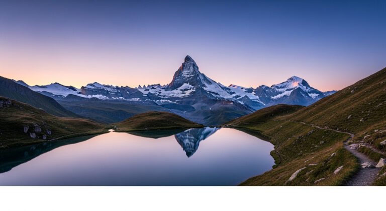
- Zermatt Hiking: The Matterhorn’s Best Trails
- Grindelwald & Jungfrau Region Hikes
- 5 Underrated Swiss Alps Hikes
- Planning Your Swiss Alps Hike: Practical Guide 2026
- The Swiss Mountain Hut Experience
- Our Testing Methodology
- Frequently Asked Questions
The Main Swiss Alps Hiking Regions in 2026
Switzerland’s hiking is organized into distinct massifs, each with its own character:
| Region | Icons | Best For | Peak Season |
|---|---|---|---|
| Bernese Oberland | Eiger, Mönch, Jungfrau | Dramatic scenery, infrastructure | July–September |
| Valais / Zermatt | Matterhorn, Monte Rosa | High-altitude trekking, Haute Route | July–September |
| Engadine / Graubünden | Piz Bernina, Swiss National Park | Solitude, wildlife, Rhaeto-Romance culture | July–October |
| Ticino | Lake Maggiore, Verzasca | Mediterranean flair, chestnut forests | May–October |
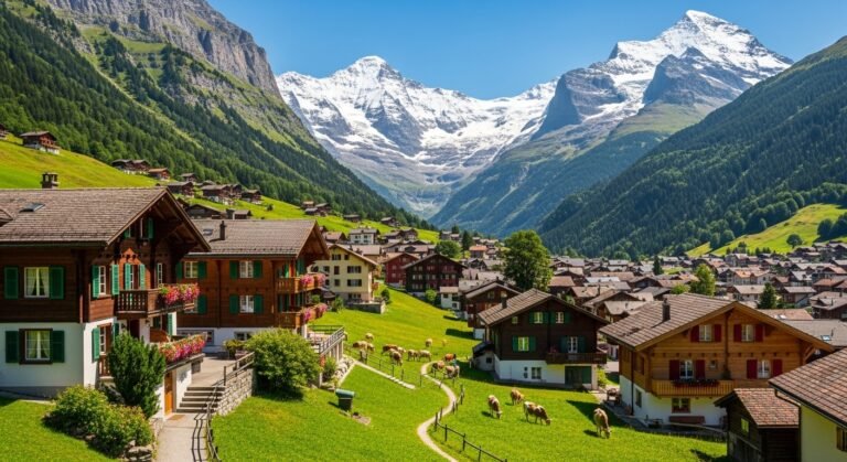
| Appenzell / Alpstein | Säntis, Seealpsee | Rolling green hills, traditional Switzerland | May–October |
Best Day Hikes in the Swiss Alps
1. Eiger Trail, Grindelwald (⭐⭐⭐⭐⭐)
Distance: 9.8km | Duration: 3–4 hours | Difficulty: Moderate | Elevation gain: +350m / -850m
The most dramatic moderate hike in Switzerland — a trail that runs directly beneath the North Face of the Eiger (3,970m), one of the most feared walls in Alpine climbing. The path descends from Eigergletscher (accessible by cogwheel train from Grindelwald) through moraines, past the actual base of the north face, to the meadows above Alpiglen.
- Highlights: Close-up views of Eiger’s north face, information panels on historic climbing expeditions, excellent Grindelwald valley panoramas
- Start: Eigergletscher station (Jungfrau Railway) — rail included in Swiss Travel Pass
- Don’t miss: The markers showing where famous expeditions bivouacked on the face
2. Schynige Platte to First Circuit, Bernese Oberland
Distance: 16km | Duration: 6–7 hours | Difficulty: Moderate | Elevation gain: +700m
One of the finest ridgeline walks in the Alps — a traverse connecting two cogwheel railway stations on a ridge high above Grindelwald with continuous 360° views of the Eiger-Mönch-Jungfrau trinity. The alpine botanical garden at Schynige Platte (open June–October) adds a unique start to the trail.
3. Gornergletscher Glacier Trail, Zermatt
Distance: 8km loop | Duration: 3–4 hours | Difficulty: Easy-Moderate
Walk down from Rotenboden (accessible by Gornergrat Railway) along the edge of the Gorner Glacier — one of the largest glacier systems in the Alps. In 2026, the glacier continues its documented retreat; interpretive panels along the trail show its extent in 1900, 1950, and today, making this an involuntary climate change education experience alongside spectacular scenery. The Matterhorn looms throughout.
4. Seealpsee Circuit, Appenzell
Distance: 10km | Duration: 3.5–4.5 hours | Difficulty: Easy-Moderate
The Swiss Alps at their most quintessentially pastoral — a high alpine lake ringed by vertical limestone cliffs in the Alpstein mountains above Appenzell. The 2026 hiking season opens this trail mid-June after snow clearance. Farm guesthouses (Berghotel Seealpsee) serve regional Käse (cheese) that is made on the alpages visible from the trail.
5. Lungern Schönbüel, Obwalden
Distance: 12km | Duration: 4–5 hours | Difficulty: Moderate
One of central Switzerland’s best-kept secrets — a ridge walk above turquoise Lungernsee with views extending to the Bernese Alps. Visitor numbers are a fraction of the Bernese Oberland equivalent trails. The descent passes through flower meadows that rival anything in more famous regions.
Best Multi-Day Swiss Alps Hikes
Tour du Mont Blanc (Switzerland Section)
Total route: 170km, 10–12 days (full loop) | Swiss section: 3–4 days
The TMB is the world’s most popular long-distance mountain trail, circling the Mont Blanc massif through France, Italy, and Switzerland. The Swiss section — entering at Champex-Lac and traversing to La Fouly and Ferret — is arguably the wildest and most scenic. The Val Ferret offers a quiet valley alternative to the more crowded French sections.
Swiss highlights: Grand Col Ferret (2,537m, Swiss-Italian border), views into the Grandes Jorasses, overnight at Refuge du Col de la Croix
Haute Route: Chamonix to Zermatt
Distance: 180km | Duration: 14–16 days | Difficulty: Strenuous (alpine experience recommended)
The Haute Route is widely considered the finest mountain trek in the Alps — a traverse from Chamonix (Mont Blanc) to Zermatt (Matterhorn) through the highest, most remote villages of the Valais. The route crosses 11 high passes above 2,500m and stays overnight in mountain villages and huts with dramatic views each evening.
- Best section for day visitors: La Sage to Arolla (day 8–9 equivalent) — accessible and spectacular
- Guided options: Several agencies offer guided Haute Route with pre-booked accommodation; recommended for those without alpine navigation experience
- Season: July 1 – September 15 (snow conditions permitting on high passes)
Via Alpina 1: Switzerland End-to-End
Distance: 390km across Switzerland | Duration: 20–26 days
The Via Alpina Stage 1 crosses Switzerland from Vaduz (Liechtenstein border) to Montreux (Lake Geneva) through nine cantons. For those with 3–4 weeks, this is the ultimate Swiss hiking experience — sampling the Graubünden, Bernese Oberland, and pre-Alps in a single journey.
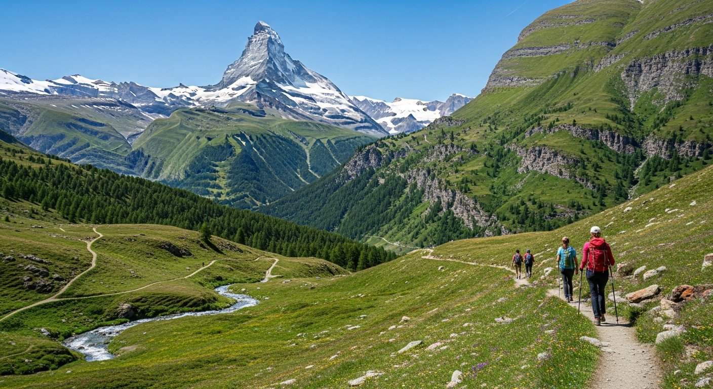
Zermatt Hiking: The Matterhorn’s Best Trails
Zermatt is car-free and served entirely by electric vehicles and the Glacier Express railway — making it the most sustainably accessible major ski/hiking resort in Switzerland.
Matterhorn Glacier Trail
Distance: 6.5km | Duration: 2.5–3 hours | Difficulty: Easy-Moderate
Walk from Trockener Steg (cable car) through a moonscape of glacial moraines with constant Matterhorn views. The trail passes the actual Theodul Glacier — a rare chance to walk within meters of a glacier surface without technical equipment.
Höhbalmen Hike: Best Matterhorn Views
Distance: 14km | Duration: 6–7 hours | Difficulty: Strenuous
A classic Zermatt route that climbs to the Höhbalmen ridge for arguably the finest Matterhorn views of any accessible trail — the mountain appears perfectly pyramidal from this angle, unobstructed by other peaks. An alpine hut (Edelweisshütte) provides lunch midway.
Schwarzsee Circuit
Distance: 8km | Duration: 3–4 hours | Difficulty: Easy
An accessible high-altitude loop around the Schwarzsee (Black Lake) at 2,583m — the highest lake directly beneath the Matterhorn. Accessible by cable car from Zermatt, making it suitable for families and those with limited fitness.
Grindelwald & Jungfrau Region Hikes
First Cliff Walk and First Flyer
The 45-meter suspension bridge and cliff-hugging walkway at First (2,168m) above Grindelwald offer vertigo-inducing views of the Eiger without requiring hiking boots. The First Flyer zip line connects back to the gondola station — a 800m adrenaline experience above 1,000m drop.
Bachalpsee and Faulhorn Ridge
Distance: 13km | Duration: 5–6 hours | Difficulty: Moderate-Strenuous
From First, walk to the reflection lake Bachalpsee (perfect morning light) then continue up the ridge to the Faulhorn summit (2,681m) — one of Switzerland’s longest-operated mountain restaurants. The descent to Schynige Platte completes one of the best full-day hikes in the Bernese Oberland.
5 Underrated Swiss Alps Hikes
- Lötschental Valley, Valais: An isolated valley parallel to Zermatt but without the crowds. Medieval villages, the Lötschentaler Museum, and trails to 3,000m accessible from the valley floor.
- Swiss National Park, Engadine: Switzerland’s only national park permits no picking, no dogs, minimal facilities — and maximum wildlife. Ibex, chamois, red deer, and golden eagles are regularly spotted. No marked huts in the park — true wilderness experience.
- Verzasca Valley, Ticino: Turquoise river pools in a deep granite gorge — swimming accessible from the valley hiking trail. The bungee jump from Verzasca Dam (007 film location) adds adrenaline if needed.
- Nufenenpass Circuit, Valais: A remote high-altitude plateau near Switzerland’s geographic center with views across four cantons. Barely signposted on tourist maps, rarely mentioned in guidebooks.
- Aletsch Glacier Panoramaweg: The Aletsch Glacier is the longest in the Alps (23km) and a UNESCO World Heritage Site. The panoramaweg ridge trail above it is known but underutilized — most visitors take the Jungfraujoch train and look from above rather than walking beside it.
Planning Your Swiss Alps Hike: Practical Guide 2026
When to Go
- Best hiking season: July 1 – September 30 (high passes snow-free)
- July: Full trail access, mountain flowers in bloom, mountain huts fully staffed
- August: Peak season — book huts 4–8 weeks in advance. Thunderstorm risk highest. Sunrises and sunsets extraordinary.
- September: Best month — golden light, declining crowds, stable weather, warm days. Some high huts close after September 15.
- Late June / Early October: Shoulder season — many trails accessible but check snow conditions for passes above 2,500m
Swiss Travel Pass
The Swiss Travel Pass covers all trains, buses, boats, and most mountain railways — including Gornergrat, Jungfraujoch (partial), and many regional cable cars. A 4-day pass (approx. CHF 244/adult) typically covers the transport cost for a week of hiking if you’re using Swiss rail connections. Buy before arriving in Switzerland for best prices.
Mountain Hut Booking
Swiss Alpine Club (SAC) huts dot the Alps every 4–6 hours of hiking. Dormitory beds run CHF 45–65 including breakfast; private rooms CHF 75–120. SAC members get significant discounts. Book online via the SAC hut reservation system at least 2–4 weeks ahead in peak season.
Compare thousands of hotels with free cancellation options.
The Swiss Mountain Hut Experience
Staying overnight in a SAC mountain hut is one of the defining Alpine experiences — nothing in the hiking world compares to waking before sunrise, eating breakfast among mountaineers preparing to summit, and stepping out into a day that begins at 2,500m.
What to expect: Dormitory sleeping (bring ear plugs and a sleeping bag liner), simple but hearty food (pasta, rösti, soup), no mobile reception, generator-powered lighting, composting toilets, and some of the best sunrises available to non-alpinists.
Top Swiss mountain huts for non-technical visitors:
- Lauteraarenhütte: Isolated deep in the Bernese glaciers — accessible by a 6-hour hike from Grimsel. Completely off the tourist radar.
- Tracuit Hütte, Zermatt: Above 3,000m with extraordinary views of the 4,000m peaks surrounding Zermatt. Accessed by a challenging but marked trail.
- Cabane du Grand-Combin, Valais: Surrounded by the Grand Combin massif — one of the most dramatic hut positions in Switzerland.
Complete Swiss Alps hiking gear guide →
Is the Swiss Travel Pass worth it? Our honest review →
Our Editorial Methodology
SwitzerlandVibe’s hiking recommendations are based on Anna Fischer’s personal experience hiking in the Swiss Alps over 12 years, including all trails and huts mentioned in this guide. Trail conditions, facilities, and access details are verified through Switzerland Tourism and local cantonal hiking organizations. We use the SAC (Swiss Alpine Club) difficulty rating system throughout. No trails are featured as paid placements.
Frequently Asked Questions
Q1: When is the Swiss Alps hiking season in 2026?
A: July 1 through September 30 for full access to high-altitude trails. Many lower trails below 2,000m are hikeable from May. September is arguably the best month — stable weather, fewer crowds, and golden Alpine light.
Q2: Do I need to be an experienced hiker to hike in the Swiss Alps?
A: Absolutely not. Swiss trails are extremely well-marked and range from easy village walks to technical mountaineering routes. The SAC difficulty system (T1–T6) makes it easy to choose appropriate routes. The majority of trails in this guide are T2–T3 (suitable for fit walkers with basic hiking footwear).
Q3: How expensive is hiking in Switzerland?
A: Trail access is free. Cable cars and cogwheel railways run CHF 20–80 return. Mountain hut accommodation runs CHF 45–120/night including breakfast. Budget CHF 150–200/day for a comfortable Swiss Alps hiking trip (transport, huts, food).
Q4: Can I hike in the Swiss Alps without a guide?
A: Yes — for trails T1–T3 (the majority in this guide), no guide is needed if you’re physically fit and have appropriate footwear and weather clothing. For high-altitude glacier routes (T5–T6) or if you plan to summit 4,000m peaks, a certified mountain guide is strongly recommended.
Q5: What is the best hike for first-time Swiss Alps visitors?
A: The Eiger Trail from Eigergletscher to Alpiglen — it’s spectacular, moderate difficulty, accessible by train, and gives you the best introduction to Bernese Oberland scale and drama. The entire experience (train up, hike down to Grindelwald) takes 5–6 hours and is unforgettable.
Editorial Disclosure: SwitzerlandVibe content is independently created. All trail recommendations are based on personal experience and are not sponsored by tourism boards or businesses.
Affiliate Disclosure: This article contains a Booking.com affiliate link. SwitzerlandVibe may earn a commission if you book through this link.